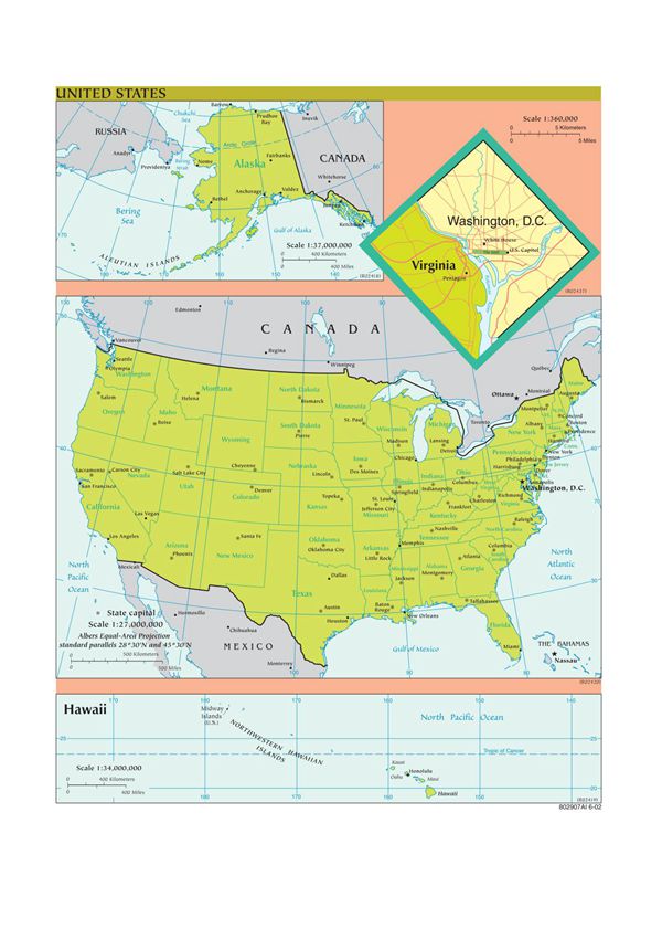
TheUnitedStatesofAmericaisavastcountrylocatedinNorthAmerica,consistingof50states,afederaldistrict(Washington,D.C.),andseveralterritories.ThisclearEnglish-languagemapprovidesanaccurategeographicalrepresentationofthenation'sdiverselandscape.Keyfeaturesshownonthismapinclude:-Stateboundarieswithclearlabels-Majorcitiesmarkedwithdotsandnames-Physicalfeatureslikemountainranges,rivers,andlakes-Interstatehighwaysandmajorroadnetworks-Neighboringcountries(CanadatothenorthandMexicotothesouth)-Surroundingbodiesofwater(AtlanticOcean,PacificOcean,GulfofMexico)Themapusesstandardcartographicconventionswithaclean,easy-to-readdesign.Itmaintainsproperscaleandprojectiontoaccuratelyrepresentdistancesandgeographicalrelationshipsbetweenlocations.Thismapservesasanexcellentreferenceforeducational,business,ortravelpurposes,offeringacomprehensiveoverviewofAmerica'sgeographicallayout.AllplacenamesappearintheirofficialEnglishspellings,makingitparticularlyusefulforEnglish-speakingusersorstudentslearningaboutU.S.geography.Thecolorschemeandtypographyarecarefullychosentoensuremaximumclarityandreadability.